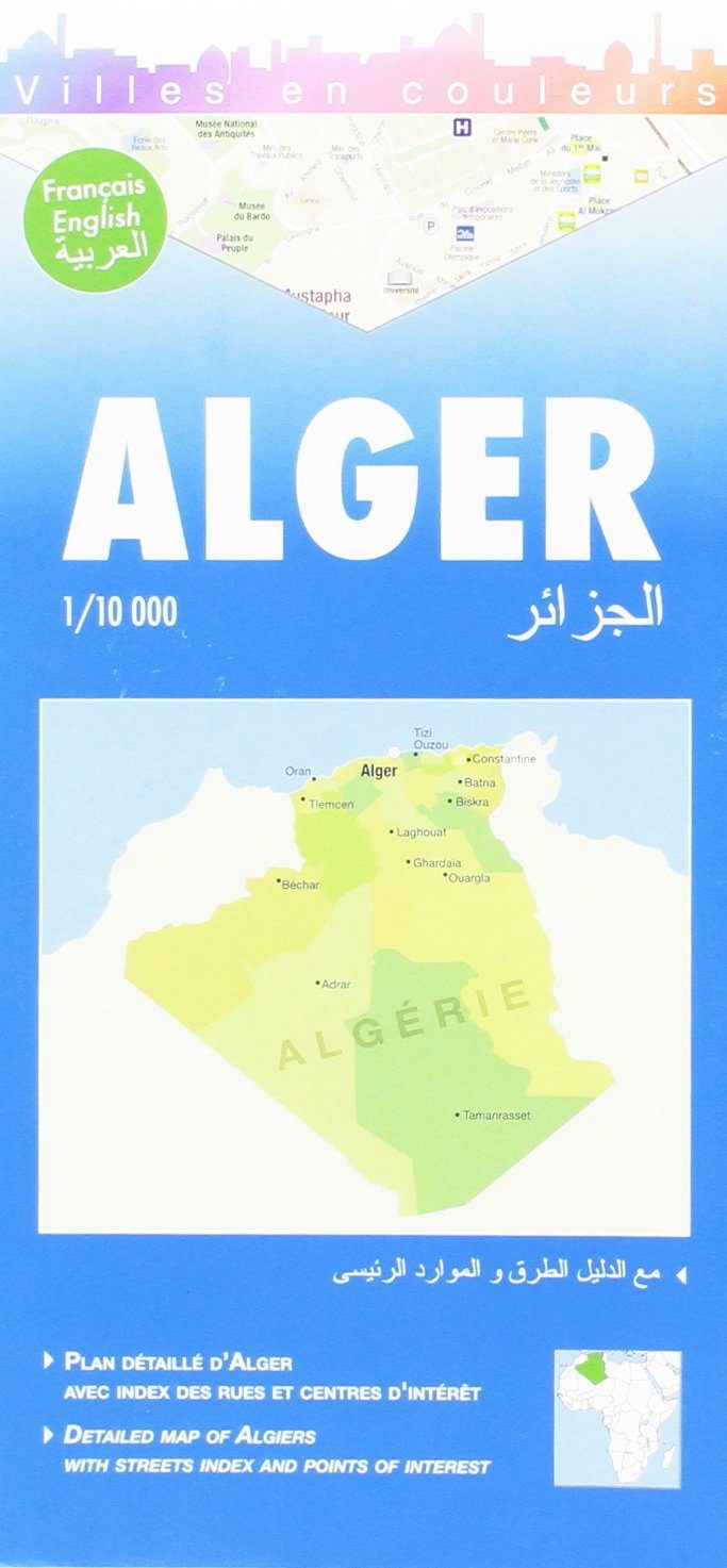
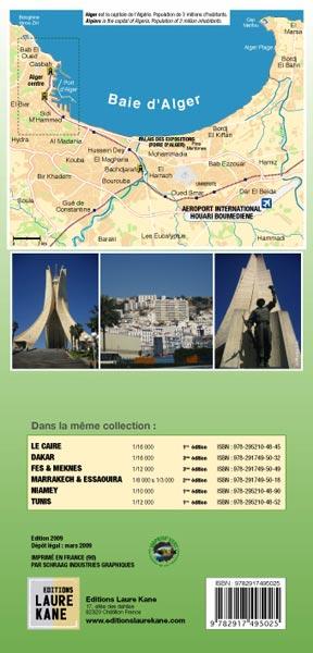
Plan de ville - Alger & environs | Laure Kane carte pliée Laure Kane

Map of City - Algiers & Surroundings | Laure Kane

Map of City - Algiers & Surroundings | Laure Kane

Regular price $13.00
/
  • Shipping within 24 working hours from our warehouse in France
  • Delivery costs calculated instantly in the basket
  • Free returns (*)
  • Real-time inventory
  • In stock, ready to ship
  • Backordered, shipping soon
Tax included.
Map of the city of Algiers, capital and larger city of Algeria, named El Djazaïr in Arabic, or nicknamed fluently "El Bahdja" or "La Blanche".

The plan extends from the hills of Bouzareah and the Pescade tip, at Maqâm Echahid (Martyr Memorial), 90 meters high and overlooking Algiers. The Notre-Dame of Africa Basilica, accessible by a cable car, is one of its most significant monuments. Do not miss the sea the ride bordered by arcades which is today the boulevard Che Guevara, the place of Emir Abdelkader, the great post that is in the city center of Algiers, the citadel, the Grande mosque. In the city, you will discover many green spaces such as the Park of Freedom and the Unmissable Test Garden.
- Index of the main streets
- Index of the main interest centers (places, hospitals, post offices, markets, museums, hotels, etc.)
- Table of distances
- Small glossary
+ Zoom on Algiers Bay


ISBN/EAN : 9782917495025
Publication date: 2009
Scale: 1/10,000 (1cm=100m)
Printed sides: front
Folded dimensions: 12 x 25cm
Unfolded dimensions: 84cm x 50cm
Language(s): French English Arabic
Poids : 80 g

Customer Reviews

No reviews yet
0%
(0)
0%
(0)
0%
(0)
0%
(0)
0%
(0)