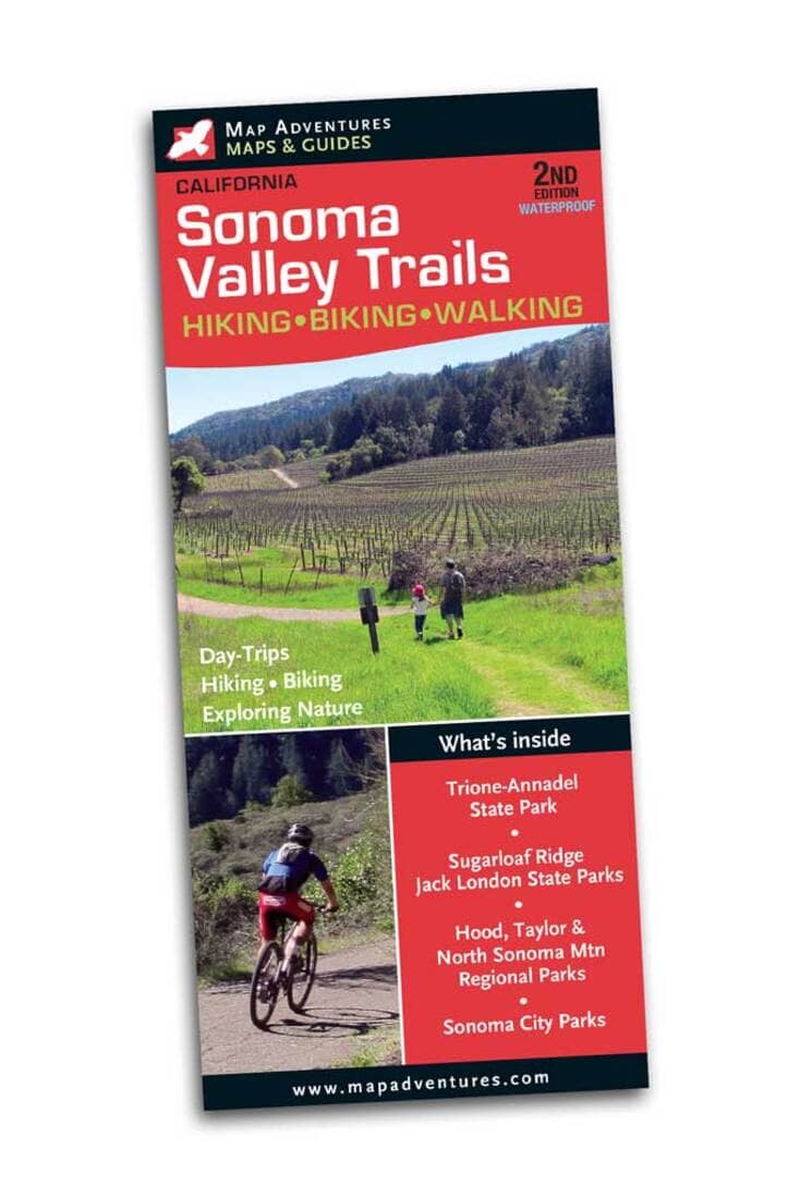
Map Adventures Sonoma, California Hiking and Biking Map is your indispensable guide to the beautiful Sonoma Valley. Experience the parks, scenic hikes, wildlife and nature that this area has to offer. Discover wineries along the way as you hike in a variety of unique climate and geography that influences the harvest. Map Features Multi-use trails, camping, parking, miles between points, index of trails, parks, conservation land and open space usage & contact information Suggested day-trips Wineries and points of interest Areas Covered Sonoma County State Parks Trione-Annadel Sugarloaf Ridge Jack London Historic Sonoma State Historic Park Sonoma Regional Parks Hood Mountain Taylor Mountain North Sonoma Mountain Maxwell Farms Spring Lake Sonoma Valley Sonoma City Parks Montini Preserve Sonoma Overlook trail Maxell Farms Regional Park
ISBN/EAN : 9781890060473
Publication date: 2018
Folded dimensions: 9 inches x 4 inches (22 x 10 cm)
Unfolded dimensions: 19.5 inches x 27 inches (49 x 68 cm)
Language(s): English
Poids :
0 g