Historical maps of the USA

138 products

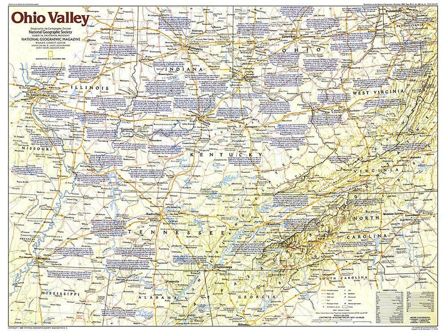
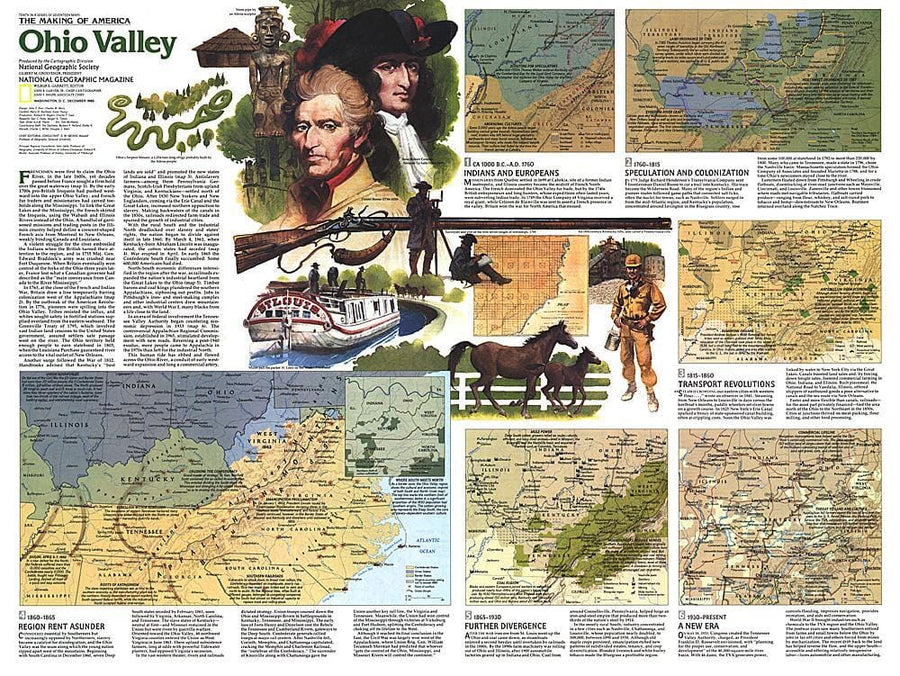
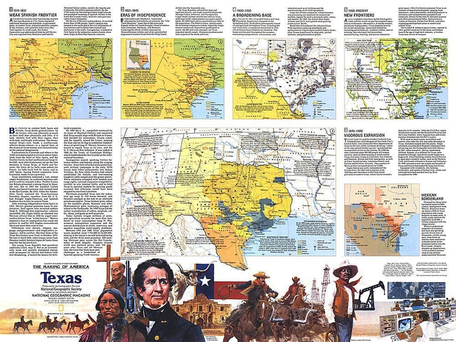
Maps Historic murals of the United States are available for sale on this page. Most of them are printed on demand.

1976 Close-up USA, Hawaii Map Wall Map
1976 Close - up USA, Hawaii Map
National Geographic Historic POD
$40.00
1976 Portrait USA Map Wall Map
1976 Portrait USA Map
National Geographic Historic POD
$53.00
1982 Southwest Map Side 1 Wall Map
1982 Southwest Map Side 1
National Geographic Historic POD
$40.00
1982 Southwest Map Side 2 Wall Map
1982 Southwest Map Side 2
National Geographic Historic POD
$40.00
1982 United States Wall Map
1982 United States
National Geographic Historic POD
$53.00
1984 Central Rockies Map Side 1 Wall Map
1984 Central Rockies Map Side 1
National Geographic Historic POD
$40.00
1984 Central Rockies Map Side 2 Wall Map
1984 Central Rockies Map Side 2
National Geographic Historic POD
$40.00
1985 Ohio Valley Map Wall Map
1985 Ohio Valley Map
National Geographic Historic POD
$40.00
1985 Central Plains Map Side 1 Wall Map
1985 Central Plains Map Side 1
National Geographic Historic POD
$40.00
1985 Central Plains Map Side 2 Wall Map
1985 Central Plains Map Side 2
National Geographic Historic POD
$40.00
1985 The Shaping of a Continent Wall Map
1985 The Shaping of a Continent
National Geographic Historic POD
$27.00
1986 Northern Plains Map Side 1 Wall Map
1986 Northern Plains Map Side 1
National Geographic Historic POD
$40.00
1986 Northern Plains Map Side 2 Wall Map
1986 Northern Plains Map Side 2
National Geographic Historic POD
$40.00
1992 Southwest, USA Map Wall Map
1992 Southwest, USA Map
National Geographic Historic POD
$27.00
1995 Above the Rockies Map Wall Map
1995 Above the Rockies Map
National Geographic Historic POD
$40.00
1995 Heart of the Rockies Map Wall Map
1995 Heart of the Rockies Map
National Geographic Historic POD
$40.00
1995 Living on the Edge Map Wall Map
1995 Living on the Edge Map
National Geographic Historic POD
$40.00