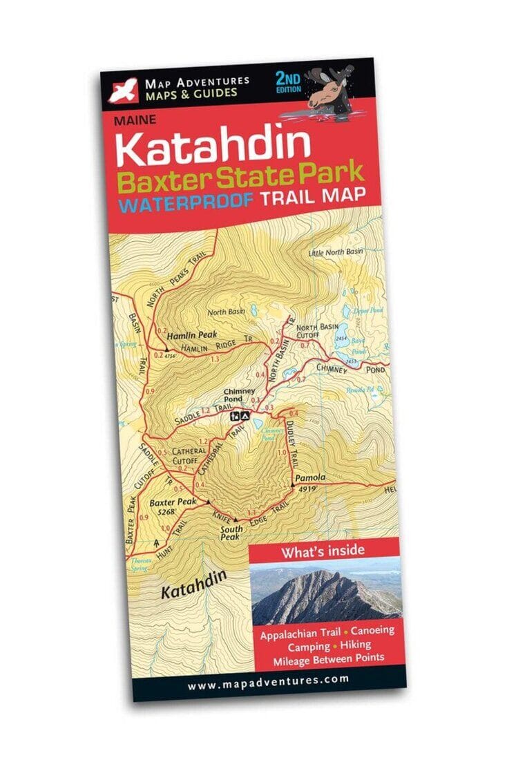
Jaw-dropping beauty and yes, you are likely to see a moose. Let Map Adventures show you why “forever wild” is an understatement when it comes to experiencing Baxter State Park. This beautiful, two-sided, waterproof map shows in great detail the 220 miles hiking trails, highlighting the many lakes, canoeing and camping opportunities the park offers. Whether you chose to traverse the Knife Edge, one of the most demanding and ambitious treks in the northeast, seek out an easier trail to explore, or rent a canoe on one of the many quiet lakes you will experience one of the wildest parts of northern Maine. Map Features Campgrounds Backcountry Camp Sites Appalachian Trail Canoe Rentals Mileage between points on hiking trails UTM/GIS Grid Index of trails Areas Covered Baxter State Park
ISBN/EAN : 9781890060312
Publication date: 2017
Folded dimensions: 9 inches x 4 inches (22 x 10 cm)
Unfolded dimensions: 27 inches x 19.5 inches (68 x 49 cm)
Language(s): English
Poids :
1.7 oz