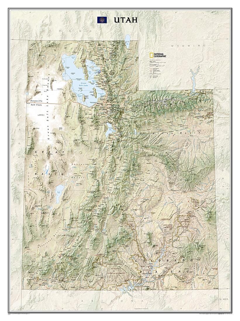
Explore the diverse and iconic landscapes of Utah with this striking National Geographic wall map. From the Bonneville Salt Flats and the Great Salt Lake to the Uinta Mountains and the extraordinary parks along the Colorado Plateau, the state is rendered in dramatic detail. Stunning shaded relief and vibrant colorization depicts mountain ranges, forests, deserts, canyons, and other physical topography. Prominent peaks, major lakes, rivers, and reservoirs, and other geographic features are highlighted. In addition to hundreds of place names, this map includes the locations of cities, major roadways and railways, airports, military bases, national and state parks, and recreation areas. Part of a growing series of State Wall Maps, this expertly designed map makes an attractive addition to any office or study.
The map is packaged in a 2"-diameter clear plastic tube. The tube has a decorative label showing a thumbnail of the map with dimensions and other pertinent information.
ISBN/EAN : 9781597752466
Publication date: 2009
Unfolded dimensions: 37.8 inches x 30.71 inches (96 x 78 cm)
Language(s): English
Poids :
220 g