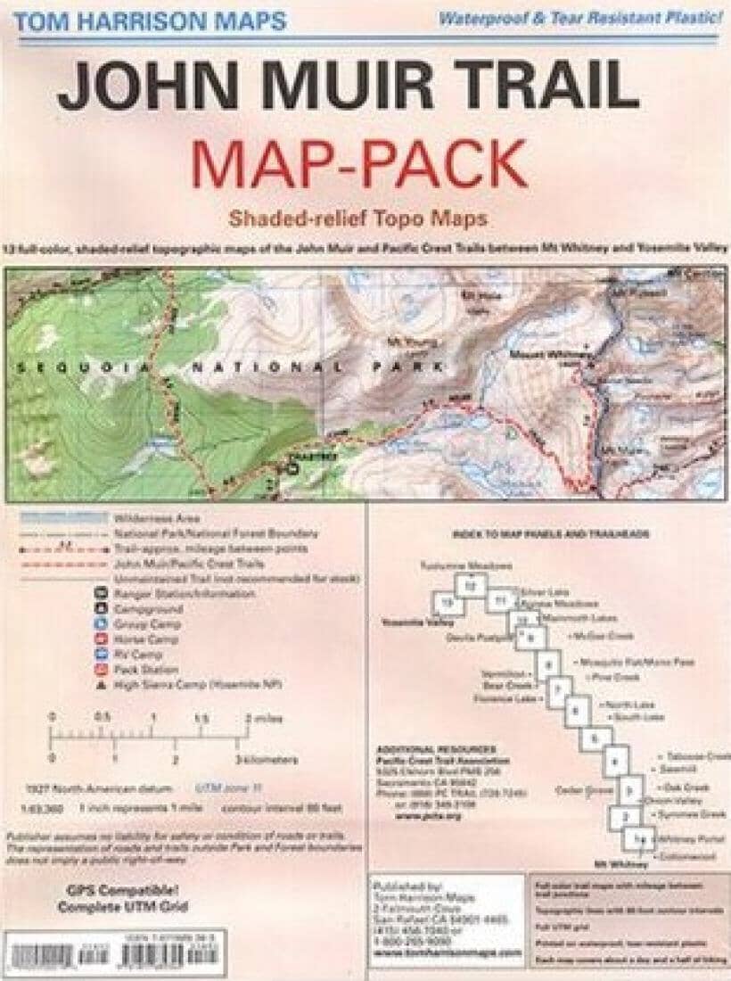
John Muir Trails Map Pack | Tom Harrison Maps
John Muir Trails Map Pack | Tom Harrison Maps
Regular price
$29.00
- Ships within 48 business hours from our US warehouse. For this product, customs fees may be requested by the carrier upon delivery.
- Delivery costs calculated instantly in the basket
- Free returns (*)
- Real-time inventory
- In stock, ready to ship
Related geographic locations and collections: California (hiking maps)