St. Johns - Newfoundland and Labrador Street Map | Canadian Cartographics Corporation Road Map

St. Johns - Newfoundland and Labrador Street Map | Canadian Cartographics Corporation

St. Johns - Newfoundland and Labrador Street Map | Canadian Cartographics Corporation

Regular price $8.00
/
  • Ships within 48 business hours from our US warehouse. For this product, customs fees may be requested by the carrier upon delivery.
  • Delivery costs calculated instantly in the basket
  • Free returns (*)
  • Real-time inventory
  • In stock, ready to ship
  • Backordered, shipping soon
Tax included.

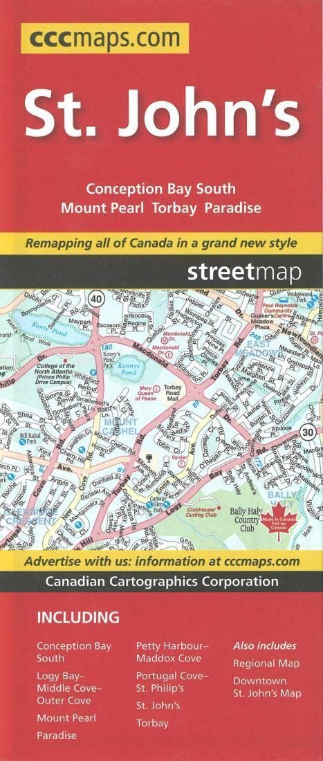
Folded map of St. Johns, Newfoundland and Labrador with detailed indices for quick and easy location of destinations. Includes communities of: Conception Bay South, Logy Bay-Middle Cove-Outer Cove, Mount Pearl, Paradise, Petty Harbour-Maddox Cove, Portugal Cove-St Philip's, St. John's and Torbay. Also includes downtown St. Johns Map and much more. Also includes regional map and downtown St. John's Map.


ISBN/EAN : 9781554861415
Publication date: 2018
Folded dimensions: 9.45 x 3.94 inch / 24 x 10cm
Unfolded dimensions: 39.37 x 27.17 inches / 100 x 69cm
Language(s): English
Poids : 1.8 oz

Customer Reviews

Be the first to write a review
0%
(0)
0%
(0)
0%
(0)
0%
(0)
0%
(0)