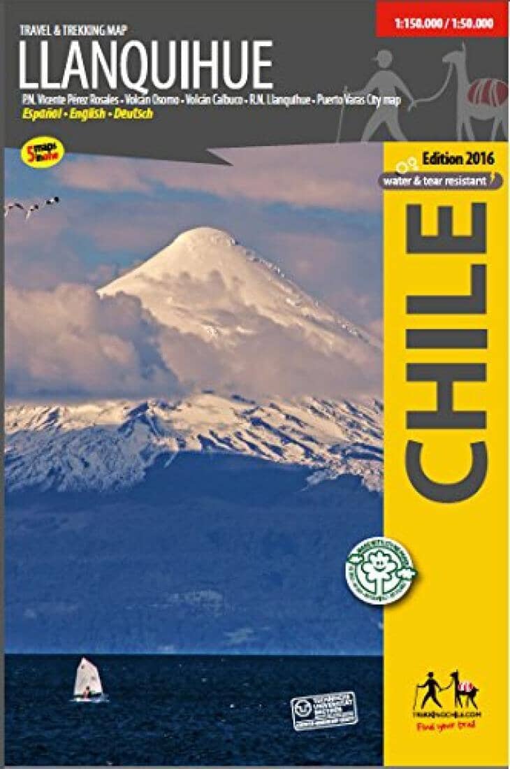
Complete and up-to-date map of the area around Llanquihue lake. Shows the Vicente Perez Rosales National Park and the Osorno and Calbuco volcanoes. With altitude levels each 50 m, hiking trails (distances in km and hours), lodgings, huts, camps etc. Landscape pictures and drawings of the local fauna. GPS compatible. 3 detail maps 1:50,000: Calbuco volcano, Osorno volcano, Rupanco - Todos Los Santos (Callao Trek). City map Puerto Varas. Map developed by the Institute for Cartography at the Dresden Technical University. Trekkingchile, 3rd edition 2016 Travel & Trekking Map, Southern Chile, scale 1:150,000 / 1:50,000 Printed on tear- and water-resistant, environmentally friendly Stone Paper. English - German - Spanish.
ISBN/EAN : 9789568925246
Publication date: 2016
Unfolded dimensions: 19.29 x 28.74 inches / 49 x 73cm
Language(s): Spanish, English
Poids :
130 g