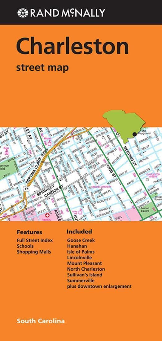
Rand McNally's folded map for Charleston is a must-have for anyone traveling in and around this part of South Carolina, offering unbeatable accuracy and reliability at a great price. Trusted cartography shows all Interstate, U.S., state, and county highways, along with clearly indicated parks, points of interest, airports, county boundaries, and streets. The easy-to-use legend and detailed index make for quick and easy location of destinations. You'll see why Rand McNally folded maps have been the trusted standard for years.
Folded map features:
Regularly updated
Full-color maps
Clearly labeled Interstate, U.S., state, and county highways
Indications of parks, points of interest, airports, county boundaries, schools, shopping malls, downtown & vicinity maps
Easy-to-use legend
Detailed & full street index
Convenient folded size
© 2014
Communities Included: Goose Creek, Hanahan, Isle of Palms, Lincolnville, Mount Pleasant, North Charleston, Sullivan's Island, Summervill


![Pacific Crest Trail: California South [Map Pack Bundle] | National Geographic carte pliée](http://mapscompany.com/cdn/shop/products/pacific-crest-trail-california-south-map-pack-bundle-national-geographic-carte-pliee-national-geographic-459576.jpg?v=1694455576&width=900)