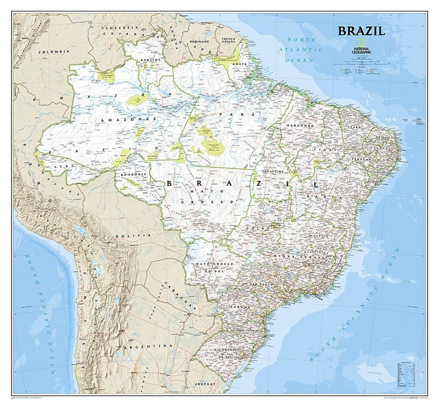
National Geographic's Brazil Classic wall map is fittingly one of the largest maps available of the largest country in Wall maps>Americas, and the fifth largest in the World. It shows the entire country in exceptional detail, including Brazil's 26 states and 1 federal district, plus the coastal islands that make up Fernando de Noronha National Marine Park, Abrolhos National Park, and Arquipelago dos Abrolhos.
The map shows over 1,000 named places including state capitals, primary and secondary towns, political boundaries, important infrastructure, and all key landforms. Brazil's national parks are clearly highlighted and labeled, as is the country's rich network of rivers that feed the Amazon-the world's second longest river.
The map is packaged in a 2"-diameter clear plastic tube. The tube has a decorative label showing a thumbnail of the map with dimensions and other pertinent information.
ISBN/EAN : 9781597752527
Publication date: 2009
Unfolded dimensions: 37.8 inches x 34.84 inches (96 x 88.5 cm)
Language(s): English
Poids :
330 g